 I love the outdoors; especially the western portion of the United States. Being able to spend my December ,running the Grand Canyon AND hiking all over Pike’s Peak National Forest area has made me about as happy as I could be.
Dr. Anna and I have been getting out to Colorado Springs as often as possible since we first started dating, and now that Southwest Airlines offers numerous flights to COS every day we have been able to get out there more often (and cheaper) than ever before. Aside from the outdoors activities, COS offers a lot of great activities within the city limits and surrounding areas, and we have several great friends who live in that region.
On this go around we were anticipating large amounts of snow in the mountains, and we were banking on doing a lot of snowshoeing in the mountains. However, it’s been a little dry out there these past few months so we had little snow to contend with, which allowed us to hike a lot more than we originally planned.
We are big proponents of maintaining a high level of physical activity, and the Colorado Springs area delivers plenty of opportunities for outdoor activities. The only problem with the COS area is that are SO MANY HIKES within a 40 minute drive, it can be overwhelming to decide which one to do. When looking for a hike you must consider how accessible the trailhead is (will you need 4WD), is it compatible with your ability level, and is it an extremely desolate hike that may require you to brush up on your survival skills?
In this article, we aim to share with you the hikes we did on this past trip and give a little guidance if you find yourself out in that area looking for a great way to get outdoors and challenge your legs a little bit (and your lungs).
First, some ground rules. #1 Download the all trails app. All trails is a fantastic app that gives maps and info on every one of these hikes we completed. I use All trails every time I’m out of town and looking for a place to hike or run. The pro version of the app is well worth the $20-30 annual cost as it allows you to download the map of the trail you’re on and navigate for you even after you’ve lost cell service (which you will).
#2 If we say a hike is easy, moderate, or hard, that is in reference to a particular level of fitness. Let’s face it, if you are not acclimated to elevation, even an easy hike will seem hard. Air gets pretty thin above 8000 feet, so be prepared. If you are looking to get up into the mountains and do a little hiking you should first prepare by doing a bit more exercising prior to your trip, and if you’re planning on getting way up in the mountains, I recommend spending 1-3 days in the city of Colorado Springs acclimating prior to heading up the big hill.
Now on to the hikes we did.
Day 1: Crags Trail and Raspberry Mountain.

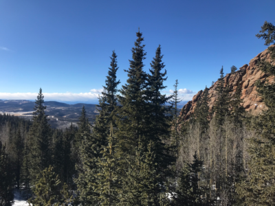
Crags trail is a 4.8 mile round trip out to a series of beautiful rock formations on the northwest side of Pike’s Peak. The trailhead is off a dirt road on the west side of Pike’s that can be reached by most regular cars, however a 4WD vehicle would be preferred (the road is very well maintained). We ventured out onto this trail at approximately 8 AM when it was still VERY cold, but thankfully for the first few miles we were shielded from the wind. About a mile in the trail splits and you can go right towards Devil’s playground or left to the Crags. We have done Devil’s playground, and it is an amazing hike with spectacular views, but it does ascend up to nearly 13,000 feet which can make for a long day if you are not acclimated to that kind of altitude.
Crags is not too difficult of a trail, and even all trails rates it as moderate and kid friendly, but like we said before, the trailhead begins at 10,000 feet above sea level and ends just under 11,000 feet, so be prepared for very little oxygen compared to Frankfort, IL. All in all it isn’t too challenging of a trail and has very gentle climbs.
About a quarter mile down the road from the Crags trailhead you will find the trail head for Raspberry mountain. After we completed Crags, we warmed up in the car and headed down to Raspberry mountain. Raspberry was a little more challenging than Crags and had a similar elevation profile, but the views from the terminus of both of these hikes was well worth the effort to get there.
Trailhead’s for both of these hikes would be about an hour drive from Colorado Springs.

Day 2: Lovell Gulch Trail and Mueller State Park
Of all the hiking we did this past week, our second day was by far the most accessible for our fellow flat landers. Despite having some elevation and some uphill elements, these two hikes are a great way to enjoy walking around the mountains and both give you a fantastic chance at seeing some elk, mule deer, and even the occasional moose.
Lovell Gulch trail is located in the town of Woodland Park (which is where we stayed) and the trailhead lies right on the north side of town and doesn’t require any 4WD or vehicle clearance to access. The trail is about a 5 mile loop with some climbs but is very well marked and well maintained and offers some spectacular views of the Pike’s Peak National Forest. (Unfortunately, we did not see any big game on this trail, just a dog that I mistakenly took for a mountain lion).

After finishing up at Lovell Gulch, we hopped in the car and drove about 20 minutes to Mueller State Park. If you are bringing the kids out to CO for a mountain vacation and looking for a great place to get outside, consider Mueller. After paying the $9 entry fee, pick up a very convenient map of all the park’s trails and drive to your preferred parking lot and head out on the trails. Every trail in this park is very well marked and signs guide you everywhere you go, making it nearly impossible to get lost. Despite the well developed infrastructure of this park, once you are on the trails you feel removed from civilization. We hit as many trails as we could until we began to run out of light and started to turn home. If you’re looking for a great place to get away into the natural world without requiring a great deal of hiking skill and equipment, mueller is an excellent place to start (as well as North Cheyenne Cañon, more on that later).
Day 3: Pancake Rock
Pancake rock was probably our most difficult effort on this trip. The trail ascends a couple thousand feet up to nearly 12,000 feet where you are treated to amazing views and awesome rock formations that resemble stacks of silver dollar pancakes. Given the elevation and the climb, this hike is no small feat. The trail head is located right off highway 67 on the southwest side of Pike’s peak. It is accessible by any car but be ready for two lane mountain driving on some curvy roads. All in all, we did 7 miles out and back on this trail and the first half is UP the entire way, but coming down gives you a nice break and we were able to get off the mountain in a fraction of the time it took to go up. If you’re planning on this hike, save your legs up and make sure you’re pretty well acclimated before getting to that elevation. Don’t make the same mistake Dr. Anna and I made back in 2015 when we hiked all the way up Pike’s Peak without proper acclimation! (nasty headaches)

Day 4: North Cheyenne Cañon, Mt Cutler, and Mt Muscoco
North Cheyenne Cañon is a gem. It’s hard to believe that it is a city park. Puts every city park to shame in Illinois. NCC (for short) has numerous trails and sweeping views of the canyons that head up into the mountains. Located right at the edge of Colorado Springs, this park is very accessible and a very short drive from anywhere in the city. We began on the Columbine trail and headed into the park. About 2 miles in we joined the trail to Mt Cutler/Mt Muscoco. After jumping on the new trail we found ourselves on top of our first summit of the day very quickly, Mt Cutler. After spending a little time on top and taking in the amazing views, we headed back down the trail and picked up the path to Mt Muscoco.

If you want to be able to head home from CO and tell your friends you summited a mountain, Mt Cutler is the place for you. You can drive straight to the trail head and shoot straight up the mountain and back down in less than two miles. Mt Muscoco, on the other hand, is a bit more difficult. If you want to summit that one, you should have a little experience scrambling over rocks, and hiking on some loose terrain and narrow footpaths. If you’re somewhat experienced, it really isn’t too bad, just maybe not a good trail for absolute beginners.
After finishing Mt Muscoco we travelled back down Daniel’s Pass Trail to the Columbine trail for the return to our car, ending a fantastic ten mile day.

Four days of hiking and approximately 40 miles total. We have done far more challenging hikes in the Springs area in the past, but with unstable snow at higher elevations we didn’t want to tempt fate with avalanches. If you head to the Springs for a vacation in the near future we hope you’ll consider some of these hikes and feel free to ask us for some more specific advice!
Before we go, here are some other hikes to consider investigating in the springs area.
-Manitou Incline
-Barr Trail
-Garden of the Gods
-Devil’s Playground
-Anything in Mueller State Park or North Cheyenne Cañon
-Anything the locals recommend!